Castroville
A local perspective.
Discover the places, stories, and people connected to Castroville.
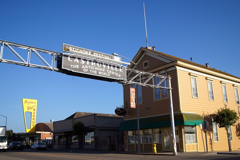

Get to know Castroville.
Castroville is a census-designated place, Monterey County, California.
Castroville: an artichoke-growing community with a longer town history
The town predates its best-known crop
The North Monterey County Chamber’s community account dates Castroville’s founding by Juan Bautista Castro to 1863. Its agricultural identity includes strawberries and lettuce as well as artichokes. A local history can start with the town before following the crop that became its best-known symbol.
A grower’s history adds a family perspective
Ocean Mist Farms’ own account traces its roots to the California Artichoke and Vegetable Growers Corporation in 1924. Daniel Pieri and cousins Amerigo and Angelo Del Chiaro leased land south of Castroville, with grower Alfred Tottino joining the venture. This is one company’s history within a larger agricultural community.
The story reaches beyond a single field
Ocean Mist identifies Castroville as its headquarters and describes farming in several growing regions. That distinction matters when reading a company story: its wider operations are not all located in Castroville. Name the particular farm or place when sharing a growing-season feature.
Community life offers other starting points
The Chamber’s introduction identifies a library, community activities and local businesses alongside agricultural processing and distribution. Those everyday institutions can be the focus of a story as readily as an artichoke field or a familiar roadside landmark.
Make a local contribution specific
A family interview, a food tradition or a feature about a business can bring more detail to this introduction. Identify the setting and date, and ask permission before entering working farmland or using someone else’s historical photographs.
Editorial review: 2026-11-10
Community details
- USGS topographic map
- Moss Landing Source ↗
- USGS geographic name ID
- 277486 Source ↗
- Population
- 7,515 (2020 Census geography) Source ↗
- Housing units
- 1,732 (2020 Census geography) Source ↗
- Median owner-occupied home value (survey estimate)
- $617,100 ± $39,411 (2020–2024 ACS 5-year) Source ↗
- Median monthly gross rent (survey estimate)
- $1,948 ± $576 (2020–2024 ACS 5-year) Source ↗
- Households (survey estimate)
- 1,579 ± 185 (2020–2024 ACS 5-year) Source ↗
- Owner-occupied households (survey estimate)
- 719 ± 146 (2020–2024 ACS 5-year) Source ↗
- Renter-occupied households (survey estimate)
- 860 ± 187 (2020–2024 ACS 5-year) Source ↗
- Land area (2020 Census)
- 2.646 km² (1.021 sq mi) (2020 Census geography) Source ↗
- Water area (2020 Census)
- 0.000 km² (0.000 sq mi) (2020 Census geography) Source ↗
- Population per land area (2020 Census)
- 2,840.5 people/km² (7,357.0 people/sq mi) (2020 Census geography) Source ↗
American Community Survey estimates cover 2020–2024 and show the 90% margin of error when available. Gross rent includes rent and applicable tenant-paid utilities. Census and survey figures describe the geography used for that release; housing estimates are historical survey figures rather than current asking prices.
Area figures use the 2020 Census boundary. Population density is calculated from the 2020 Census population divided by its land area, excluding water.
Locate Castroville
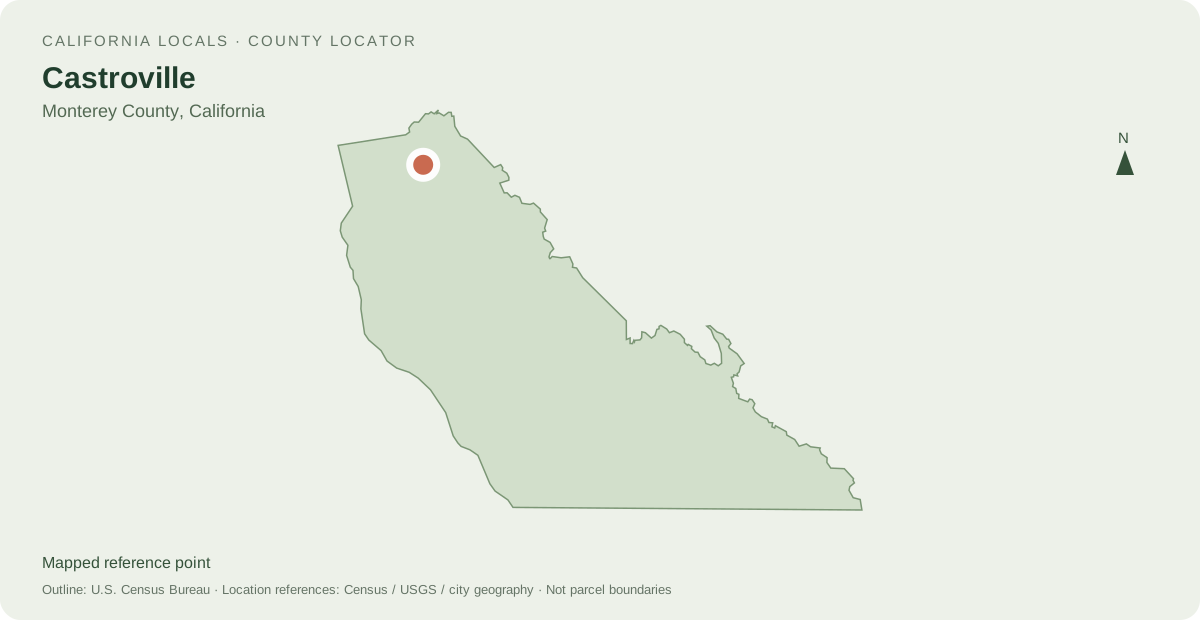
Other mapped places to explore
- Moss Landing 5.4 km between map reference points
- Elkhorn 6.0 km between map reference points
- Marina 9.9 km between map reference points
Distances are straight-line measurements between mapped reference points, rather than walking or driving distances.
Local information and resources
Powered by LocalRealtors.com
Homes for sale in Castroville
Listings with mapped coordinates inside the published U.S. Census Bureau place boundary. Listing address-city names can differ from this mapped area.
Scroll within the listings to see more homes and source details. Property links open on LocalRealtors.
Community guides
From local creators
Share a local perspective on Castroville. Approved creator posts appear here when they are tagged for this community.
Location sources
Neighborhood names and boundaries can overlap and vary by source.